Yanjiu Conference logo

Call for Papers – ICRSEG 2027, Makassar

International Conference on Remote Sensing and Environmental Geoinformatics — ICRSEG 2027

Dates

28–29 June 2027

Venue

Makassar, Indonesia

Field

Remote Sensing and Environmental Geoinformatics

Topics of ICRSEG 2027

Original papers are invited in Remote Sensing and Environmental Geoinformatics. Submit by 27 May 2027.

Submit Your Paper

Topics include, but are not limited to:

Advancements in Remote Sensing Technologies

  • Innovative sensors for environmental monitoring
  • High-resolution satellite imagery applications
  • Real-time data acquisition techniques

Geospatial Data Analysis Techniques

  • Statistical methods for geospatial data interpretation
  • Machine learning in geoinformatics
  • Spatial-temporal modeling approaches

Applications of Remote Sensing in Environmental Studies

  • Impact assessment of land use changes
  • Urban heat islands and their monitoring
  • Biodiversity conservation using remote sensing

Challenges in Environmental Geoinformatics

  • Data integration from diverse sources
  • Handling large-scale geospatial datasets
  • Issues of data quality and accuracy

Policy and Management Implications of Geoinformatics

  • Geoinformatics in natural resource management
  • Policy frameworks for remote sensing technologies
  • Community engagement in geoinformatics projects

Important Dates

Conference opens in

00days
00hours
00min
00sec
  1. Step 1

    Submission Deadline

  2. Step 2

    Registration Deadline

  3. Step 3

    Conference Date

Download

Get the official templates and forms for ICRSEG 2027. Use the latest versions when preparing your submission.

Peer Review Process

Follow each step from abstract submission to awards and recognition.
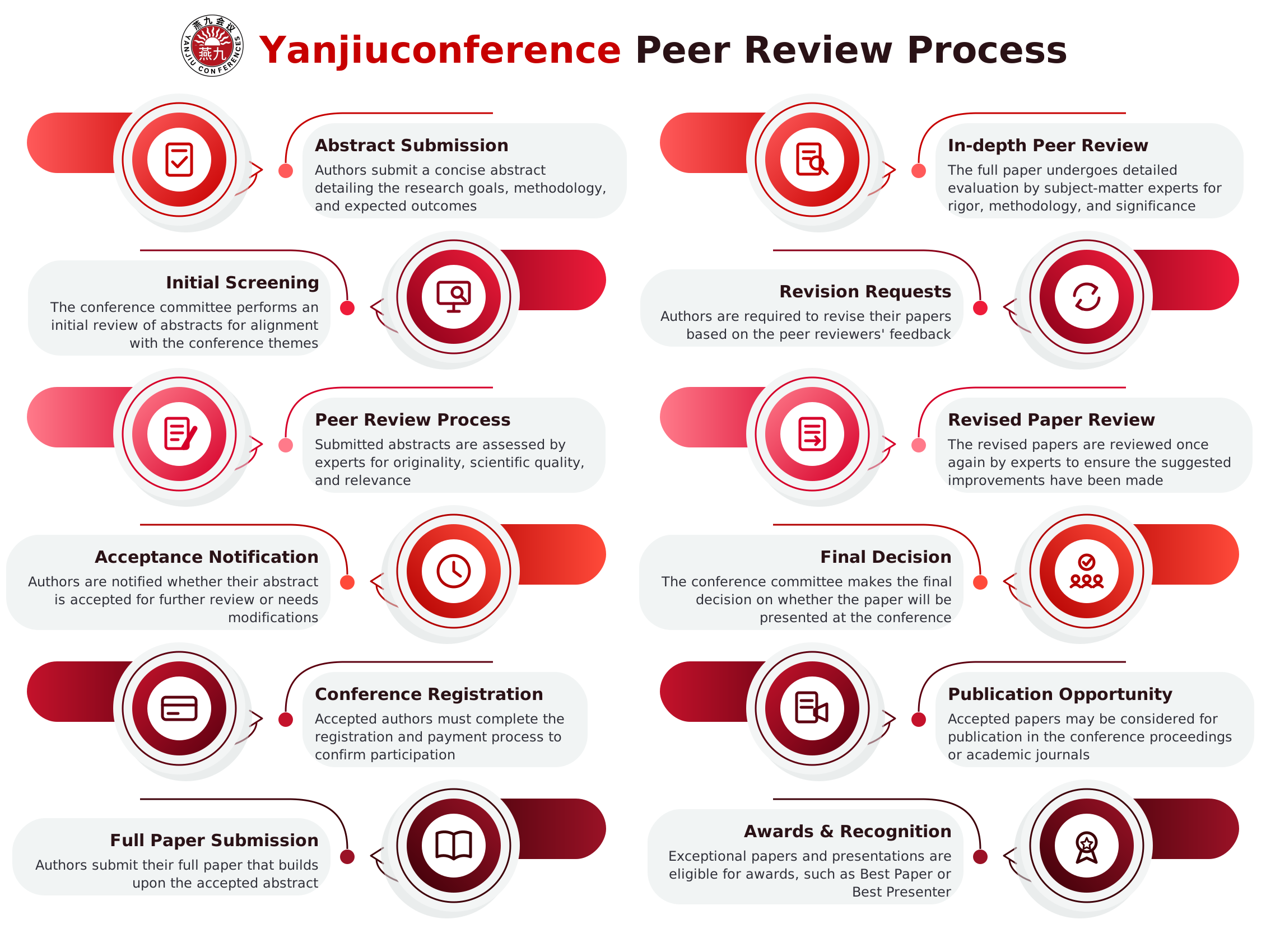
Yanjiuconference peer review process: 12 steps from abstract submission to awards and recognition

See You in Makassar This June

Present your research, meet peers from over 50 countries and help shape the future of Remote Sensing and Environmental Geoinformatics.