Yanjiu Conference logo

Call for Papers – ICGTNHA 2027, Makassar

International Conference on Geospatial Technologies and Natural Hazard Assessment — ICGTNHA 2027

Dates

28–29 June 2027

Venue

Makassar, Indonesia

Field

Geospatial Technologies and Natural Hazard Assessment

Topics of ICGTNHA 2027

Original papers are invited in Geospatial Technologies and Natural Hazard Assessment. Submit by 27 May 2027.

Submit Your Paper

Topics include, but are not limited to:

Remote Sensing Applications

  • Satellite data for disaster monitoring
  • Aerial imagery analysis techniques
  • Advancements in LiDAR technology

GIS for Hazard Mapping

  • Spatial analysis for risk assessment
  • Integration of social data in hazard maps
  • 3D modeling of hazard-prone areas

Data Integration Techniques

  • Combining geospatial and meteorological data
  • Use of big data in hazard prediction
  • Interoperability of geospatial databases

Community Resilience and Planning

  • Geospatial tools for disaster preparedness
  • Public participation in risk assessment
  • Impact of urban planning on hazard vulnerability

Climate Change Impacts

  • Modeling natural hazards under climate scenarios
  • Influence of sea-level rise on coastal hazards
  • Adaptation strategies using geospatial data

Predictive Modeling and AI

  • Machine learning for hazard prediction
  • AI-driven assessments of disaster impacts
  • Geospatial analytics for real-time decision making

Important Dates

Conference opens in

00days
00hours
00min
00sec
  1. Step 1

    Submission Deadline

  2. Step 2

    Registration Deadline

  3. Step 3

    Conference Date

Download

Get the official templates and forms for ICGTNHA 2027. Use the latest versions when preparing your submission.

Peer Review Process

Follow each step from abstract submission to awards and recognition.
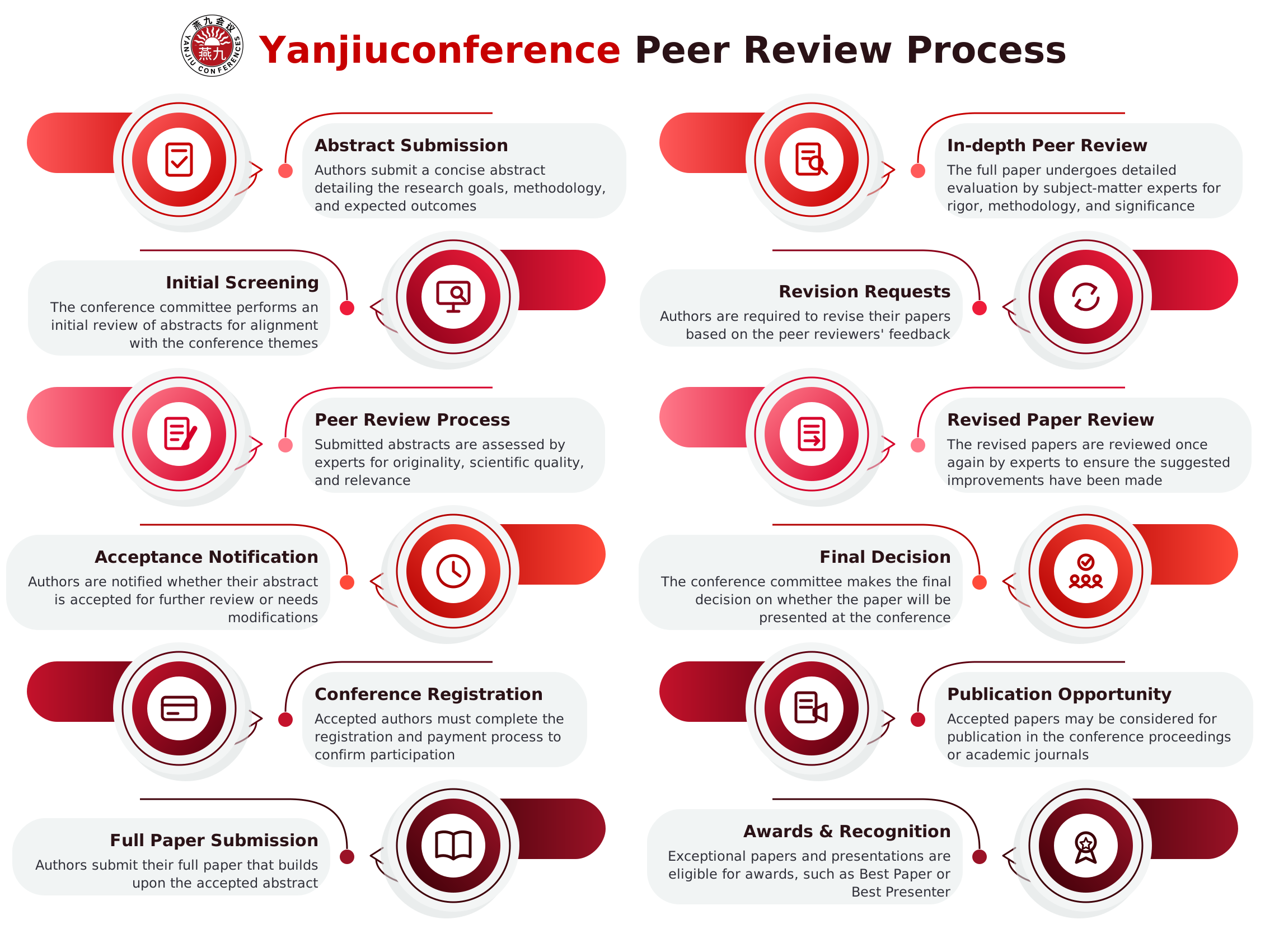
Yanjiuconference peer review process: 12 steps from abstract submission to awards and recognition

See You in Makassar This June

Present your research, meet peers from over 50 countries and help shape the future of Geospatial Technologies and Natural Hazard Assessment.